The settlement of Sauran is located 44 km north-west of the city of Turkestan. It is a monument of republican significance, with coordinates: 43˚31.106΄, 067˚46.337΄. The late medieval city of Sauran is considered a continuation of the early medieval settlement Karatobe-Sauran (4th-14th centuries), located about 3 km to the southeast.
The earliest written records about Sauran date back to the first half of the 10th century. It is mentioned by al-Istakhri (“Book of Routes of Countries”) and al-Maqdisi. Later references appear in Ibn Hawqal’s work (976), as well as in the anonymous geographical treatise “Hudud al-Alam” (10th century). In the 13th century, Sauran is mentioned in the writings of the Armenian King Hetum I, Ibn al-Athir, and Yaqut (“Dictionary of Countries”). These sources mainly refer to the history of the settlement Karatobe-Sauran (4th-14th centuries).
In the 15th–16th centuries, references to Sauran become much more frequent. The city is described in the works of Mu‘in ad-Din Natanzi (“Anonymous of Iskandar”), “Tawarikh-i Guzida-yi Nusrat-name,” Molla Shadi (“Fath-name”), Kamal ad-Din Bina’i (“Shaybani-name”), Ruzbihan Isfahani (“Mihman-name-yi Bukhara”), Zayn ad-Din Wasifi (“Bada’i al-Waqa’i”), and Hafiz Tanysh (“Sharaf-name-yi Shahi”). In Russian sources, the first mentions of Sauran date to the 17th century.
According to medieval records, in the 10th century Sauran was surrounded by seven fortress walls and functioned as a fortified border city of the Oghuz, built against the Kipchaks. In the early 13th century, it is described as a border city that did not pay kharaj, and in the mid-13th century as a large urban center. In the 14th century, Sauran was part of the Ak Orda and is sometimes even mentioned as its capital. In the 15th-16th centuries, the city became an important center in the struggle for power in Turkestan between the Kazakh Khanate and the Shaybanids.
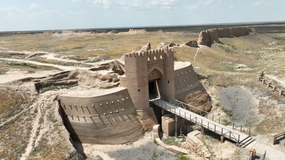
The modern site of Sauran measures 850 m from north to south and 660 m from east to west. The preserved fortress walls reach a height of 3-6 meters in some places. The city could be entered through two gates - from the north and south sides. At the corners and gates there were 7 defensive towers, and the total length of the fortress walls was 2360 meters. The walls were built from mudbrick and pakhsa on a 2-3 meter-high earthen platform (stylobate). The highest tower, located in the northern corner, reached 6 meters. Around the fortress there was a moat 4-5 m deep and 15-20 m wide.
The decline of Sauran began in the 1680s of the 17th century. In the 18th century, P.I. Rychkov described it as a “small settlement near Turkestan.” By the first half of the 19th century, the city had completely ceased to exist.
Sauran was studied by numerous expeditions: in 1867 by I.P. Lerch, in 1947 by the South Kazakhstan Archaeological Expedition led by A.N. Bernshtam, in 1967 by the Zhetysu Expedition of K.A. Akishev, in 1986 by the expedition of the Institute of History, Archaeology and Ethnography named after Ch.Ch. Valikhanov, and also in 1998-2014 by the Turkestan Archaeological Expedition, in 2005–2009 by the Archaeological Center of the Khoja Ahmed Yasawi International Kazakh-Turkish University, the A.Kh. Margulan Institute of Archaeology, and other research organizations.
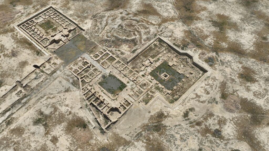
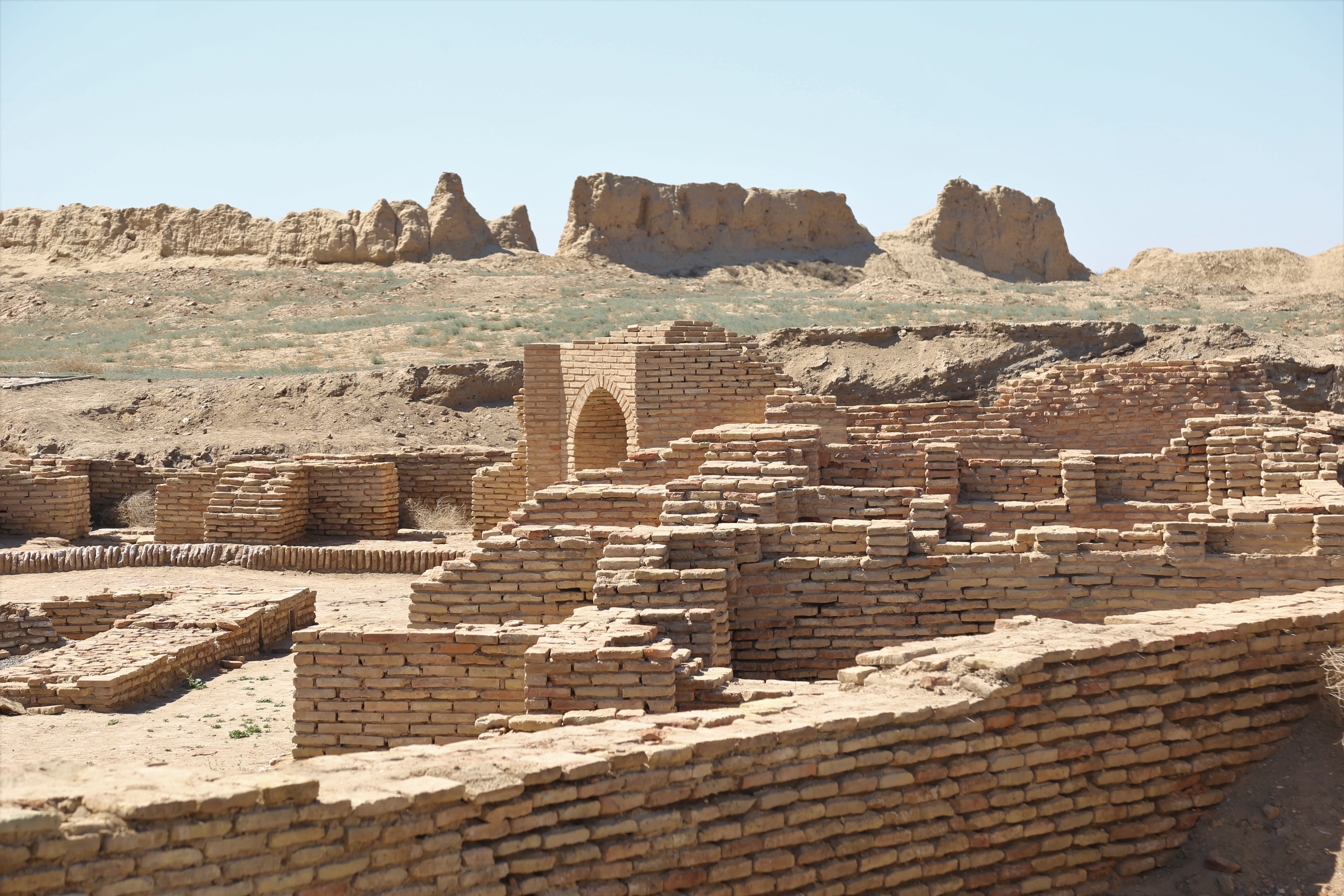
As a result of these excavations, the central square of the city, the Sauran madrasah (15th-16th centuries), a Sufi khanaka, and the central mosque (15th century) were uncovered and partially restored. In addition, the northern gate, a 172-meter main street, the moat and bridge in front of the gate, and defensive towers were excavated and reconstructed.
Thus, Sauran was a major medieval center that played an important political, military, and spiritual role in the region, and today remains a valuable archaeological heritage site of Kazakhstan.
Source: azretsultan.kz