
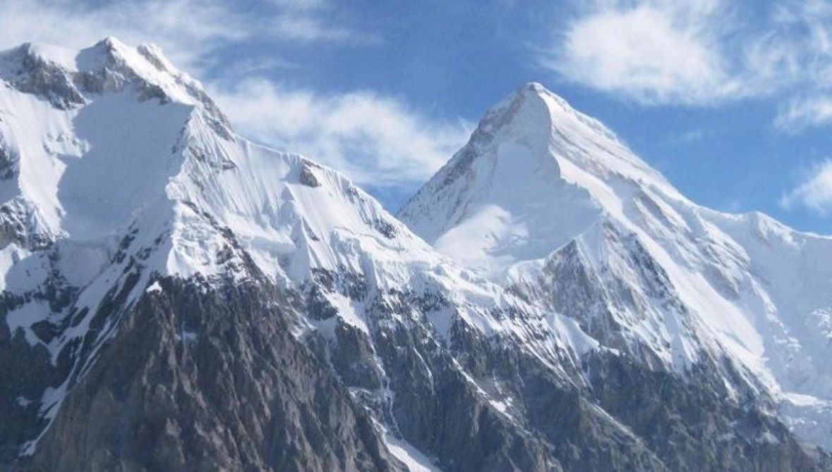
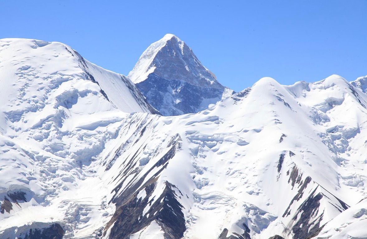
Хан Тәңірі - Орталық Азиядағы ғана емес, бүкіл әлемдегі ең көркем әрі ерекше шың. Ол Орталық Тянь-Шаньда, Қазақстан, Қырғызстан және Қытай шекаралары түйісетін Тәңір-Тау жотасында орналасқан. Мұз жамылғысымен қоса есептегенде биіктігі шамамен 7010 метр, ал табиғи пішіні айқын көрінетін өткір тетраэдрлік пирамидаға ұқсайды.
«Хан Тәңірі» атауы түркі тілінен аударғанда «Аспан иесі» деген мағына береді. Бұл шың таң атар сәтте Тянь-Шань тауларының арасынан ерекше жарқырап көрініп, оны алғаш көрген адамдар үшін ұмытылмас әсер қалдырады.
Ежелгі дәуірлерде бұл аймақ түркі халықтарының рухани және мәдени орталықтарының бірі болған. Таулар тек табиғи нысан емес, сонымен қатар киелі әлем ретінде қабылданған: түркі танымында Тәңір - жоғарғы әлемнің иесі, ал Умай мен Ерлік сияқты бейнелермен бірге дүниенің құрылымын түсіндіретін жүйенің бөлігі болған. Тәңіршілік сенімінде ол адамдардың тағдырын айқындайтын, өмір мен билікті реттейтін ең жоғары күш ретінде сипатталады.
Ежелгі деректер мен шежірелерде бұл өңір туралы мәліметтер кездескенімен, ұзақ уақыт бойы нақты ғылыми зерттеу болмаған. Қытай жылнамалары мен кейінгі византиялық жазбаларда да бұл шың туралы жанама деректер сақталған. Алайда оның биік әрі тік орналасуы себепті көп уақыт бойы толық зерттеу мүмкін болмаған.
XIX ғасырдың екінші жартысынан бастап Тянь-Шаньға ғылыми экспедициялар ұйымдастырыла бастады. Сол кезеңде бұл таулы аймаққа терең ену техникалық тұрғыдан өте қиын болған.
Хан Тәңірі туралы алғашқы ғылыми сипаттамалардың бірі Петр Петрович Семенов-Тянь-Шанскийдің 1856-1857 жылдардағы зерттеулерімен байланысты. Ол бұл шыңды алғаш көріп, оның ерекше пішінін ғылыми түрде сипаттап жазды. Ғалымның әсерлі жазбаларында шыңның қарлы пирамида сияқты көкке шаншылып тұрған бейнесі ерекше суреттеледі.
Сонымен қатар жергілікті халық арасында бұл шың «Кан-Тау» немесе «Қанды тау» деген атаумен де белгілі болған, себебі күн батар кезде оның беткейлері қызғылт реңкке боялады.
Кейінгі зерттеулерде неміс географы әрі альпинисті Готфрид Мерцбахердің экспедициялары (1902-1903, 1907-1908) Тянь-Шаньның картографиясын нақтылауға үлкен үлес қосты. Ол шыңның биіктігін шамамен 7200 метрдеп бағалап, аймақтың географиялық құрылымын сипаттап берді.
ХХ ғасырда Хан Тәңірі альпинизмнің ең күрделі және беделді шыңдарының біріне айналды. Мұнда алғаш болып кеңес және шетелдік альпинистер бірнеше бағыттан көтеріле бастады. 1930-жылдардан бастап түрлі экспедициялар шыңның оңтүстік және басқа беткейлерін зерттеді. Кейінгі жылдары бұл аймақ топографиялық және ғылыми тұрғыдан толық зерттеліп, шыңның нақты табиғи келбеті мен биіктігі анықталды.
Хан Тәңірі бүгінде әлемдік альпинизмнің символына айналған. Мұнда ондаған өрлеу маршруттары бар, кейбір бағыттар бойынша көтерілу бірнеше күннен екі аптаға дейін созылады.
Шыңның етегінде әйгілі «Хан Тәңірі» халықаралық альпинистік лагері орналасқан. Ол жыл сайын жүздеген альпинистер мен туристерді қабылдайды және халықаралық спорттық шаралар өтетін маңызды орталық болып саналады.
Бүгінде Хан Тәңірі - табиғи сұлулығы, тарихи маңызы және рухани мәні тоғысқан, әлемдегі ең ерекше таулардың бірі.
Дереккөз: astana.citypass.kz